Tuesday, October 30, 2012

A Few Storm Surge Photos from Hurricane Sandy

Surge inundating Battery Park, NY on Monday, October 29. Source: http://www.slate.com/articles/news_and_politics/gallery/2012/10/hurricane_sandy_floods_the_eastern_seaboard.html


Surge pours down an elevator shaft in New York City on Monday, October 29. Source: http://www.ticotimes.net/Current-Edition/News-Briefs/Apocalyptic-scenes-as-New-York-bears-brunt-of-Sandy_Monday-October-29-2012


Storm surge pours into New York City on Monday, October 29, 2012. Source: http://www.cnbc.com/id/49603293

Monday, October 29, 2012

Catastrophic Storm Surge Pounds Northeast


Storm surge levels in The Battery, or southern region of Lower Manhattan, have exceeded nine feet this evening. Storm tide (surge + tide) levels are approaching 14 feet, which means water has almost certainly flooded Lower Manhattan. Source: NOAA Tides and Currents


Surge levels at King's Point exceeded 12 feet earlier this evening. Fortunately the peak surge arrived near low tide. Although surge levels are slowly falling, high tide is approaching, which is keeping the total water level over 13 feet. These levels mean flooding is likely occurring over portions of northern and northeastern NYC. Source: NOAA Tides and Currents

Sandy's catastrophic storm surge has arrived along the Mid-Atlantic and Northeast Coast. A brief update on water levels:

1. Water levels in The Battery are 13.81 feet above Mean Lower Low Water (a datum over which we measure surge levels.) This is more than nine feet above normal tide levels for this evening, and may move Sandy's surge into first place all time for this location. However, these data must be adjusted for tides and datums, then compared on equal footing with other storms.

2. Storm surge levels exceeded 12 feet at King's Point, on the southwest portion of Long Island Sound. This is a tremendous surge level for this area, as Sandy pushed water from E to W through the Sound. This likely flooded portions of New York City, including the eastern Bronx.

3. Winds in the New York metro area have shifted more towards the south, which has increased surge levels near The Battery but enabled surge levels to drop a bit at King's Point.

Water levels overnight will remain extremely localized, but will likely be highest in areas such as Northern NJ, The Battery and portions of NYC exposed by water to the south and southeast, as well as the south coast of Long Island. Strong southerly winds will also make it difficult for excess water to drain out of Long Island Sound.


Listen to Isaac


Image: http://www.awesomestories.com/assets/isaac-cline1


We would be prudent to listen to the words of Isaac Cline, the Chief Meteorologist at Galveston, Texas, when the great Galveston Hurricane of 1900 hit. Prior to landfall, the winds were blowing strong offshore, yet water levels were rising. Then, as the storm made landfall, the winds quickly changed direction and the water levels rose incredibly fast!

Read his words below....especially the quote that, "the sudden rise of 4 feet brought it [the water] above my waist before I could change my position."

Quote from Isaac Cline:

The water rose at a steady rate from 3 p.m. until about 7:30 p.m., when there was a sudden rise of about four feet in as many seconds. I was standing at my front door, which was partly open, watching the water, which was flowing with great rapidity from east to west. The water at this time was about eight inches deep in my residence, and the sudden rise of 4 feet brought it above my waist before I could change my position.

Story source: http://www.history.noaa.gov/stories_tales/cline2.html

Bringing this back to Hurricane Sandy:

Winds right now are generally blowing from the northeast across much of coastal NJ and NY. This is driving water down Long Island Sound from east to west, causing the highest surge levels (according to NOAA Tides and Currents) of more than eight feet at King's Point (on extreme SW Long Island Sound.) Surge levels at Battery Park are between 6.5 and 7 feet. 

Beware of sudden water level rise in The Battery, NYC area, and south-facing shores of Long Island, this evening. After Sandy makes landfall in NJ, winds will quickly change direction, blowing in from the SE, then S, which may cause rapid water-level rises near NYC. You may not have time to escape the sudden water-level rise.


Sandy Pounding Coast with Surge and Waves


Source: http://www.newsday.com/news/weather/hurricane-sandy-speeds-up-as-officials-give-last-warning-to-evacuate-1.4162130?qr=1

Sandy is pounding the East Coast with surge and waves. Surge is overwashing roads and flooding buildings in some places. This pic above shows wave action slamming the coast on Long Island.

Speaking of Long Island, the highest surge level available right now on the NOAA Tides and Currents is actually from Kings Point, on the extreme southwest portion of Long Island Sound, where surge levels are 7.62 feet, as of approximately 5:00PM EDT. This means winds are blowing hard from the E or NE, pushing water down Long Island Sound from E to W.

Surge levels at Sandy Hook, NJ were 7.37 feet, and in other portions of coastal NJ and NY, surge levels ranged from 5 to 7 feet. Large, destructive waves are riding on top of this surge.

Sandy is forecast to make landfall in the next few hours. Peak surge levels often occur near the time of landfall, to the "right" of the storm path.

Take note- after Sandy makes landfall, the wind direction in Northern NJ, NYC, and Long Island, should be from the southeast. This will likely produce even higher surge levels in these areas, even though the eye of the hurricane already hit the coast. Winds will eventually come from the south on Tuesday, which will push surge into the southern portion of Long Island, Long Island Sound, CT, RI, and MA. Southerly winds may keep surge levels near NYC high through Tuesday.

Some areas of southern Long Island may be experiencing offshore winds, if winds are howling from the northeast right now. This may serve to temporarily reduce surge levels, however, when winds come from the southeast or south later, surge levels may rapidly rise.


High water is washing over the roadway in Ocean City, MD
http://www.usnews.com/pubdbimages/image/39015/FE_DA_121028sandy_ocmd425x283.jpg


Lessons from Previous Storms

One last entry this morning. Just wanted to quickly summarize two main points that we can learn from storm surge history of the Mid-Atlantic/ Northeast Coast.

1. No storm in modern history has taken this track

The Southern Climate Impacts Planning Program (SCIPP) recently plotted maps which depict the storm tracks and storm surge/ storm tide levels of previous hurricanes to impact the Mid-Atlantic/ Northeast Coast. An interesting observation is that no previous hurricane in modern history has taken a track similar to Hurricane Sandy, which will approach the coast from the southeast.

That said, it is important to realize we're entering unprecedented territory with this storm. This means we should have lower confidence in surge forecasts because we've simply never been here before and have not been able to validate surge models. It's always prudent to approach uncertainty with caution, and all interests along the Mid-Atlantic and Northeast Coast, particularly in New Jersey, the New York City area, and Long Island, should be prepared for a catastrophic storm surge potentially exceeding 12 feet.

2. The 1944 Hurricane and Hurricane Donna (1960) demonstrated the ability of surge to pile up in "the corner" near New York City

Although the 1944 Hurricane and Hurricane Donna (1960) passed to the east of New York City, the highest surge levels in the area were near the city/ Northern New Jersey, even though these areas were on the "weak" side of the storm (see maps on previous blog post.) This should prove as a testament of the ability of that section of coast to trap storm surge and quickly enhance surge levels.

What will happen this time, as this portion of coast (Northern Jersey/ NYC) is in the area of highest surge risk for the first time? We don't know, as this is new territory, but an abundance of caution should be taken and people in this area should follow evacuation areas as communicated by authorities.

Comparing Sandy to a "typical" Mid-Atlantic hurricane


Hurricane Sandy's track, or storm path, will likely help generate a catastrophic storm surge along the Mid-Atlantic and Northeast Coast Monday and Tuesday, including the New York City area. This storm is taking an unprecedented track, as it turns to the northwest and will make landfall at a more perpendicular angle to the coast, unlike most storms, which travel along the coast. The graphics above show the difference between Sandy and "typical" Mid-Atlantic hurricanes.

The Southern Climate Impacts Planning Program (SCIPP) identified surge and storm tide levels in other destructive hurricanes that impacted New York City (see earlier blog post). All of these previous storms took a track "along the coast," which means Sandy's path, and storm surge, may be unprecedented.

All interests from the Delmarva Pensinsula to Cape Cod should monitor this storm closely. The largest and most destructive surge will likely occur to the north of landfall, in Northern New Jersey, the New York City area, Long Island and Long Island Sound. Keep in mind that Sandy is a very large storm, so surge levels will rise rapidly long before the storm makes landfall, likely inundating evacuation routes by early Monday.

Sandy to bring unprecedented, catastrophic surge to Mid-Atlantic and Northeast Coast


Sandy to Generate Unprecedented Storm Surge in Northeast

Hurricane Sandy will generate an unprecedented storm surge along the Mid-Atlantic and Northeast Coast on Monday and Tuesday. In this blog post, I will answer questions I’ve been receiving about this surge event.

1.    Will Sandy’s surge really be worse than previous storms?

Sandy will likely produce a large and destructive storm surge along the Mid-Atlantic and Northeast Coast. Sandy’s track, or storm path, is unprecedented, so it’s a bit difficult to compare this storm with other surge events. Unfortunately, Sandy will approach the coast from the southeast and make landfall south of New York City. This is likely the worst-case-scenario track for New York. Surge tends to pile up to the right of the storm track, and this storm will very effectively pile up water in New Jersey, New York, and Southern New England.

2.    Is it a good sign that Sandy is forecast to “miss” New York and make landfall in New Jersey?

Sandy’s forecast landfall along the central New Jersey Coast is actually a worst-case storm track for the New York City area, at least in regards to storm surge generation. THIS STORM TRACK HAS NEVER BEEN OBSERVED IN MODERN HISTORY, so there is a lot of uncertainty as to what it means. It is very possible that a catastrophic surge will devastate the coast, especially in Northern New Jersey, New York City and Long Island, with a peak surge that could exceed 12 feet in some areas.

Keep in mind that a large hurricane like Sandy will generate very widespread and severe impacts, so it will be hard to “miss” this storm, even if the track shifts. Catastrophic storm surge may extend from the Delmarva Peninsula to Cape Cod. The exact track will not matter so much for many people, unless you manage to get on the “left” side of the storm track, where surge levels will be much lower.

3.    When should I evacuate?

Sandy has a very large wind field. This enables the storm to push a lot of water, even long before the storm approaches landfall.

Hurricane Ike was a large hurricane that hit Texas in 2008. Although the storm was only a category-2 on the Saffir-Simpson scale, its massive size enabled it to push tremendous amounts of water, flooding evacuation routes as long as 24 hours before landfall. More than 600 people had to be evacuated from the Bolivar Peninsula because they waited too long, and their evacuation routes were flooded by the time they decided to leave.

If you’re in coastal New Jersey, low-lying areas of New York, coastal Long Island or Long Island sound you may need to evacuate ASAP to avoid drowning in this event! This may be a life and death scenario for many people in coastal communities!

4.    How does Sandy’s surge height and extent compare to other hurricanes?
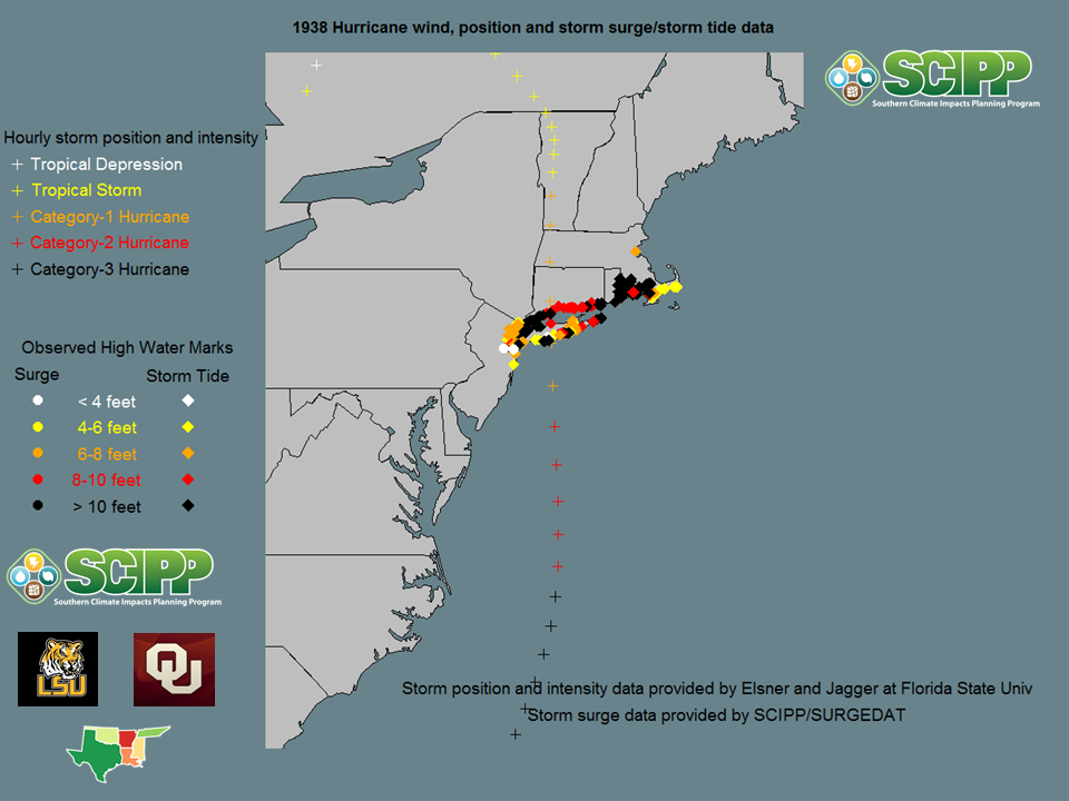
The Southern Climate Impacts Planning Program (SCIPP) at Louisiana State University and the University of Oklahoma has created the world’s most comprehensive storm surge database, which has now identified more than 6,000 high water marks along the U.S. Atlantic and Gulf Coasts. We’ve identified surge and storm tide levels for several major storms that impacted the New York City area. See previous blog posts for the storm track and water levels of these storms.

The major difference with Sandy is that it is taking an unprecedented track. Instead of moving northward, along the coast, the storm is forecast to take a turn to the west and make landfall in a more perpendicular fashion (coming at the coast instead of riding along the coast.) This should much more effectively pile up water in Northern Jersey, near New York City, along Long Island and Long Island Sound.

5.    What exactly is storm surge? Does that water level include waves?
A storm surge is really a dome of sea-water that is elevated. This dome may extend for hundreds of miles. The storm surge level is the height to which the sea level is raised above normal, and this height does not include waves. Think of it as a new sea level.

So if a community with an elevation of five feet above sea level is inundated with a 12-foot surge, this means the water will be about seven feet above street level. This water level does not include large, destructive waves that will pound buildings near the coast.

6.    What do you mean when you say water will be “pushed into the corner” near New York City?
The shape of the coastline can greatly increase the storm surge levels. Concave areas of coastline, which bend “inward,” generally trap storm surge and create higher water levels. The coastline near NYC curves on a sharp angle, which will greatly elevate surge levels, especially if a storm makes landfall south of NYC. However, storms usually approach NYC from the south, and curve to the east before approaching the city, making this piling up process less effective.

For our friends in the Northeast who are more accustomed to shoveling snow than dealing with hurricanes, think of this example. Do you know how snow can pile up in a corner when you have to shovel your driveway? As you push snow along and you approach a corner, the snow piles up quickly there because it has nowhere to go but up. This is very similar to what can happen in a hurricane. Sandy is pushing tons of water towards NJ and NY and this water is essentially trapped in a sharp angle of the coastline.

Hurricane Isaac generated a surprisingly high storm surge in coastal Louisiana this summer as it pushed water against a similar “corner” along the Mississippi Delta. Many people were shocked that a category-1 hurricane was able to generate a surge greater than 13 feet high. However, this large storm kept piling water up against this “corner” in the coastline, producing a devastating surge in some communities.

Sunday, October 28, 2012

Hurricane Irene (2011)

Just last year, Hurricane Irene pounded much of the East Coast with extensive surge and torrential rain. Storm tide levels in the New York City area reached around 8-10 feet, depending on the source, and some people say the water came within a few inches of topping the wall at Battery Park. Therefore, New York City barely dodged a bullet, as the subway system and critical electrical infrastructure could flood if the sea wall is overtopped with storm surge. We can only hope to dodge another bullet with Sandy! Note: The track for this storm is not yet available.

This is the fifth and final historic map of hurricanes that generated storm surge/ storm tide in the NYC area.

Hurricane Gloria (1985)

Hurricane Gloria tracked right along the East Coast and made landfall just east of New York City in 1985. This storm gave me a vacation day when I was in fifth grade! I didn't see any storm surge, but I do remember extensive flooding in the Allentown, PA area, as more than seven inches of rain fell. The highest official surge observation in SURGEDAT with this storm was along the Outer Banks of North Carolina. However, we must investigate this storm a bit more. When I was in Saybrooke, CT a few years ago, locals told me that Gloria produced the highest surge in memory.

This is the fourth of five historic maps related to hurricanes that produced storm surges in the NYC area.

Hurricane Donna (1960)


Hurricane Donna made landfall in North Carolina, then reemerged into the Atlantic, before making a second landfall in eastern Long Island. This storm produced a record-breaking 11-foot storm tide at Battery Park in New York City (http://www.nyc.gov/html/oem/html/hazards/storms_hurricanehistory.shtml.) Note that Donna, like the 1944 storm, produced a higher storm tide to the left of its track, near New York City, than it did on the "strong side" of the storm.

This is the third of five maps depicting storm surge/ storm tide history for storms that impacted the New York City area.

The 1944 Hurricane


The 1944 Hurricane produced terrific wind damage in Southeastern New England, and dangerous storm surge from New Jersey to Cape Cod. It is interesting to note that the highest water levels occurred to the west of the storm track, in coastal New Jersey. Such observations may provide evidence regarding the vulnerability of northeastern New Jersey and the New York City area to surge. The coast bends at a sharp angle near New York City, which can trap water and elevate surge levels in this area.

This is the second of five maps depicting historic storms that generated storm surge that affected the New York City area.

The 1938 Hurricane


The 1938 Hurricane produced a massive surge and storm tide that exceeded 10 feet from near New York City east to near New Bedford, Massachusetts. Although the storm made landfall as a category-1 hurricane, it packed category-3 winds less than 12 hours before landfall on Long Island.

This is the first of five maps depicting historic storms that generated storm surge that affected the New York City area.

Sandy likely to slam Mid-Atlantic Coast

Sandy is forecast to slam the Mid-Atlantic Coast early this week. Although the storm will likely make landfall early Tuesday morning, wind and surge impacts will likely begin to worsen on Monday. This image from the GFS model forecasts Sandy to be wound up with a steep pressure gradient, centered off the Delaware or New Jersey Coast on Monday afternoon.

Source: http://moe.met.fsu.edu/cgi-bin/gfstc2.cgi?time=2012102818&field=Sea+Level+Pressure&hour=Animation

Friday, October 26, 2012

Sandy May Be A Dandy


All eyes are on Hurricane Sandy as she moves north in the northern Bahamas this morning. (See image from NHC above.) Sandy is forecast to track north, then northeast, and then do something rather unprecedented- turn back towards the northwest and make landfall somewhere in the Mid-Atlantic Coast.

Given the current forecast, Sandy could generate a devastating storm surge in the Mid-Atlantic States, New York City area, Long Island, and the southern coast of New England.

It is unusual for storms to curve back to the northwest or west once they track from south to north and pass the Carolinas.

This unusual path may be a worst-case track for some areas, at least for storm surge generation. Given the current forecast, coastal New Jersey and New York would be on the strong side of the storm with strong onshore winds. Typically, hurricanes curve to the northeast, keeping these areas on the weak side of the storm.

It is important that coastal interests do not look too much at the storm category and compare Sandy to storms like Irene (2011) or Gloria (1985). These storms tracked along the coast, but did not curve back to the west like the forecast for Sandy. Even if Sandy becomes a tropical storm or a sub-tropical system, under the current forecast, this event could pile up considerable water along the coast, including in the New York City area.

Stay tuned to the National Hurricane Center, National Weather Service and local media for updates. SCIPP is not involved at this time with surge models for this area, but other universities and agencies may produce interesting surge models/ forecasts, particularly because this event could be potentially catastrophic for this highly populated coastline.