Thursday, March 24, 2016

Why Palm Beach County Residents May be Unprepared for Storm Surge Flooding

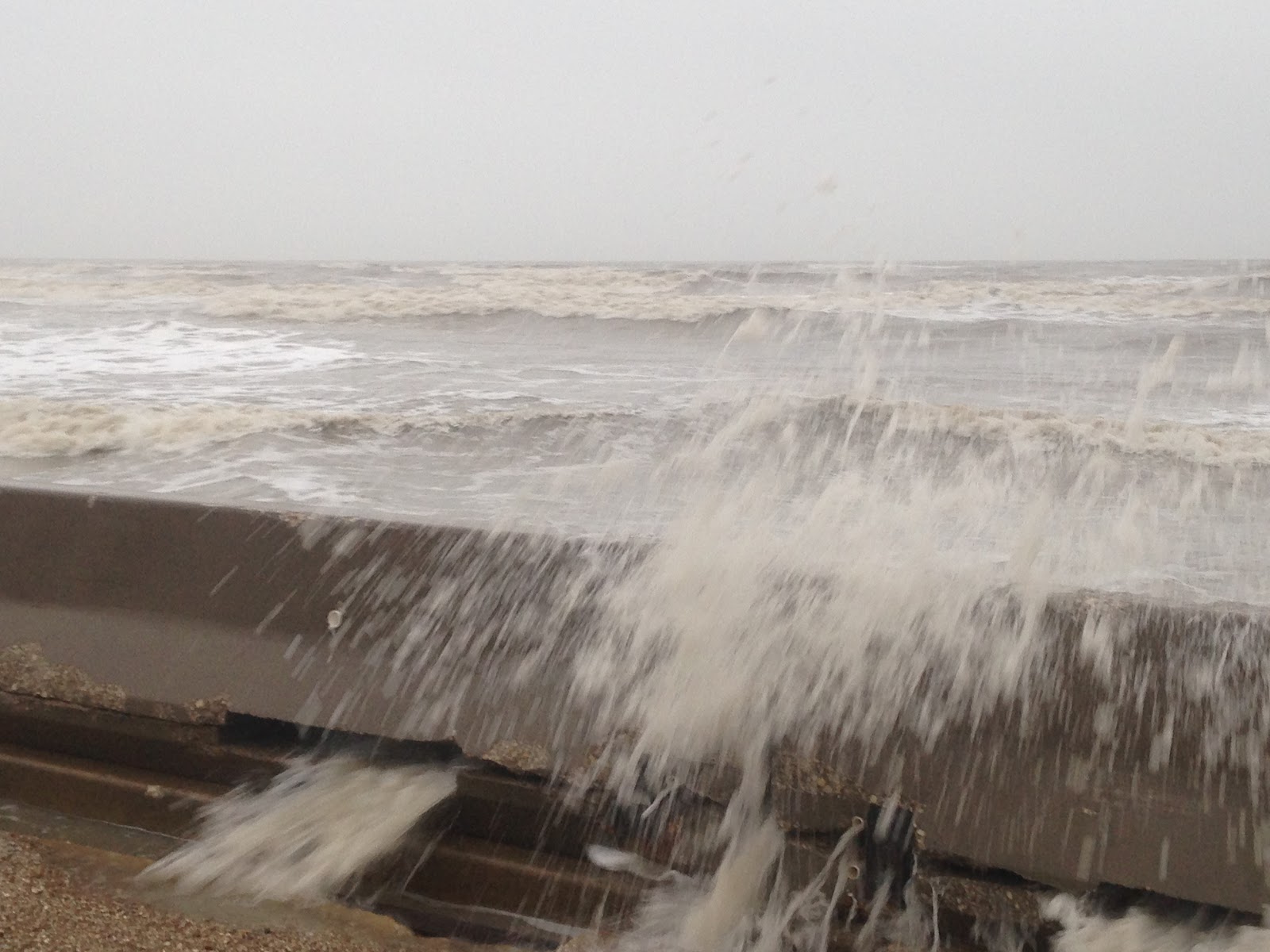
On September 17, 1947, a category-4 hurricane struck southeast Florida, generating an 11-foot storm surge at Palm Beach (Barnes 2007). The sea water at Palm Beach on that date reached the highest recorded level, even topping a 9.8-foot storm tide generated by the "Lake Okeechobee Hurricane" of 1928 (Harris 1963). Both of these storms generated high enough storm surges to inflict substantial damage along the coast.


The 1947 Hurricane smashed the coastline of Palm Beach County with a powerful storm surge. This photograph of the Seacrest Hotel in Delray Beach was taken at the northwest corner of Ocean Boulevard and Atlantic Avenue. Image Courtesy: Florida Memory: State Library & Archives of Florida (https://www.floridamemory.com/items/show/38352).


In fact, since 1926, five hurricanes have generated coastal floods at least 7 ft high in Palm Beach County; this level was reached in 1926, 1949 and 1965, and exceeded by hurricanes in 1928 and 1947. However, all of these events occurred more than 50 years ago, as the area has enjoyed an absence of large storm surges over the past five decades. Why is this?

The absence of large storm surges in this region during recent decades partly has to do with climate and partly has to do with luck, randomness, chance or fortune (pick your favorite term).


Time series of storm surges near Palm Beach/ West Palm Beach from 1880- present. Larger chart available on Palm Beach/ West Palm Beach U-Surge page at: http://www.u-surge.net/palm-beach-west-palm-beach.html.

Climatologically, hurricane activity in South Florida was suppressed from around 1968-1994 due to a negative phase in a climate teleconnection called the Atlantic Multidecadal Oscillation (AMO). Climatic teleconnections are links between weather or pressure patterns and resulting weather phenomena, like hurricanes. El Nino is a familiar teleconnection.

The AMO relates to a temperature index of the Sea Surface Temperature (SST) in the Atlantic. When the AMO is in a positive (warm) phase, the SSTs are relatively high and hurricane activity generally increases. When the AMO is in a negative (cold) phase, however, SSTs are relatively low and hurricane activity generally decreases. The AMO was negative from around 1968-1994, meaning there was less activity in those years, followed by a more active period beginning around 1995 (
Kossin and Himont 2007). 


The AMO Index relates to average sea surface temperatures in the Atlantic Ocean. Negative phases, depicting colder than normal temperatures, occurred between 1900-1925 and approximately 1968-1994. These periods were preceded and followed by warm phases. Image: https://en.wikipedia.org/wiki/Atlantic_multidecadal_oscillation.


However, Hurricanes Hugo (1989) and Andrew (1992) were two major hurricanes that struck the Southeast U.S. during the AMO cold phase, which proves that these teleconnections relate to general correlation, but do not mean there will be an absence of powerful hurricanes.

Randomness also plays a role in hurricane impacts at a particular site, and Palm Beach has been a "lucky" location in recent decades, at least concerning hurricane storm surge.

​The 1990s saw Hurricanes Andrew (1992), Erin (1995) and Irene (1999) impact Southeast Florida, but none of these storms generated a substantial storm surge in Palm Beach County because of their their tracks and landfall locations. Hurricane Andrew inflicted catastrophic wind and surge damage in Miami-Dade County, as cat-5 winds and a 16.9 ft storm surge tore through areas south of Miami (Rappaport 1993). However, storm surge levels north of Fort Lauderdale were modest, and typically not even observed. Hurricane Erin made landfall well north of the area, near Cocoa Beach, so the strongest winds in Palm Beach County were blowing offshore. And Irene approached from the southwest, so the water it was pushing mostly impacted the Keys and Everglades.

In the 2000s, hurricanes continued to strike southeast Florida, inflicting the greatest damage on Palm Beach County in 2004. That September, Hurricanes Frances and Jeanne inflicted substantial wind damage on the county. However, since these storms made landfall near the county's northern border, the strongest winds in the area were blowing offshore and suppressing surge levels. Frances produced elevated water levels on the coast, with water levels at Lake Worth Pier reaching 6.3 ft above the NAVD88 datum (Wang and Manausa 2013). Within 10 miles of the Palm Beach/ West Palm Beach area, Jeanne produced a maximum surge of around 3.5 ft (National Weather Service 2010).


Hurricane Jeanne struck much of Palm Beach County with maximum sustained winds exceeding 70 mph, however, the strongest winds were blowing offshore since Jeanne made landfall north of the area. Due to this track, Palm Beach County experienced substantial wind damage but relatively little storm surge damage. (Note: wind damage was greater in Martin County, to the north. Image printed in Wang and Manausa (2005).

Several more hurricanes followed in 2005, and although storms like Katrina and Wilma generated substantial wind and rain, their track and intensity were not ideal for generating large storm surges near Palm Beach.

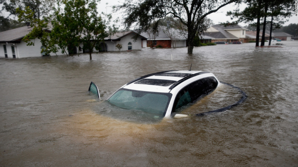
This lack of large surges over more than five decades may leave many residents of Palm Beach County unprepared for saltwater inundations in the future.

Massive population growth in this region will substantially increase storm surge impacts even if future storm surges do not surpass the frequency or magnitude of surges in the past. From 1970 to 2014, Palm Beach County has grown by more than 400%, as the population increased from approximately 349,000 to 1,398,000 (U.S. Census 2014). That's an addition of more than one million people in 45 years.

This 2007 air photo depicts widespread suburban sprawl encroaching on a water-logged area of the northern Everglades in Palm Beach County. Massive population growth in recent decades places more people at risk from storm surge and sea-level rise. Image Courtesy Herald-Tribune Archive/ The New York Times.

Sea level rise has also increased the ocean level in recent decades, meaning a lower magnitude storm surge today could reach the same water levels reached in the 1960s, because the seawater has a head start. Unfortunately, many people along Florida's Atlantic coast may feel that sea level rise is an issue restricted to Miami-Dade and Broward counties, but will not affect Palm Beach County and points north.


Long story short, Palm Beach County is vulnerable to inundation from coastal flooding, but because of climatological factors and a bit of good luck, the area has avoided any substantial storm surges for more than 50 years. Many local residents are transplants who have never experienced a hurricane before, and long-timers likely think of hurricanes as wind events instead of storm surge events, given the history of the past five decades. We can only hope residents realize their luck will run out and salt water will once again inundate their coastal communities.


REFERENCES


Barnes, J., 2007: Florida’s Hurricane History, 3rd Edition, University of North Carolina Press, Chapel Hill, North Carolina, USA, 407 pp.


Harris, D.L., 1963. Characteristics of the Hurricane Storm Surge. United States Weather Bureau, Technical Paper No. 48. Available on the web at: http://www.csc.noaa.gov/hes/images/pdf/CHARACTERISTICS_STORM_SURGE.pdf.


Kossin, J.P., and D.J. Himont, 2007: A More General Framework for Understanding Atlantic Hurricane Variability and Trends. Bulletin of the American Meteorological Society, DOI: 10.1175/BAMS-88-11-1767.


National Weather Service, 2010: Hurricane Jean, Miami- South Florida Weather Forecast Office, Miami, Florida. Available on the Web at: http://www.srh.noaa.gov/mfl/?n=jeanne.


​Rappaport, E., 1993: Preliminary Report, Hurricane Andrew, 16-28 August, 1992. National Hurricane Center, Miami, Florida, USA. Link: http://www.nhc.noaa.gov/1992andrew.html.


U.S. Census, 2014: Census of Population and Housing. Link: http://www.census.gov/prod/www/decennial.html.


​Wang, R., and M. Manausa, 2005: Hurricane Jeanne, Characteristics and Storm Tide Evaluation, Draft Report. Submitted by Beaches and Shores Resource Center, Florida State University, 11 pp. Link: https://www.dep.state.fl.us/beaches/publications/pdf/tropical/2004/strmtide/jeanne.pdf.


​Wang, R., and M. Manausa, 2013: SBEACH High-Frequency Storm Erosion Model Study for Palm Beach County, Final Report. Submitted by Beaches and Shores Resource Center, Florida State University, 52 pp. Link: https://www.dep.state.fl.us/beaches/publications/SBEACH/sbeach-PalmBeach-FinalReport1.pdf.

Wednesday, March 9, 2016

Storm System Showcases Heavy Rainfall Coupled with Prolonged Surge

A deep low centered over South Texas has dumped substantial rainfall over portions of Texas and Louisiana, while generating prolonged onshore winds and storm surge that has led to minor coastal flooding. As heavy rains continue today, this storm may showcase the combined effect of a heavy rain event coupled with a prolonged storm surge.

This storm was forecast to dump more than 10" (25 cm) of rain in some areas, as it pulls persistent bands of rain off the Gulf Coast. NOAA's 2-day QPF map issued Tuesday morning forecast 5-10" (12-25 cm) of rain from Tuesday- Thursday morning over portions of eastern Texas and western Louisiana.


NOAA's 2-Day QPF Map forecasted 5-10" (12-25 cm) of rain over portions of
Eastern Texas and Western Louisiana. 


Coastal flooding was already starting late Tuesday afternoon along the Texas Coast near the junction of Hwy 124 and 87, south of Winnie, according to Galveston County's Office of Emergency Management (@galvcountyoem).  Such flooding was accurately forecasted by the Houston-Galveston National Weather Service office, as Tuesday was the second consecutive day with strong onshore winds.

Coastal flooding was starting by Tuesday afternoon, according to Galveston County's Office of Emergency Management @galvcountyoem.


I went to this site this morning (Wed Mar 9) to document conditions on "Day 3" of this onshore wind event. Water was still washing over the seawall, but not as much as yesterday. No water was over Hwy 87 from Hwy 124 to the Ferry.

Some water was washing over the seawall at TX Hwy 87 and 124 this morning, but not as much as yesterday. Photo: Hal Needham

There was evidence that seawater had washed onto Hwy 87 earlier this morning, probably around the pre-dawn high tide. But by 7:00AM the water had receded. Photo: Hal Needham


Chaotic waves are common at Rollover Pass. Rough seas in the area this morning pushed waves over a wall near the TX Hwy 87 bridge. There was no standing water over the roadway.
Photo: Hal Needham

By late Tuesday afternoon, water levels at the north jetty of Galveston Bay were already around 1.3 ft above normal and rising, according to a NOAA tide gauge at that site. The strongest winds, and highest surge levels, were forecast for Tuesday night and early Wednesday morning, as the Houston-Galveston National Weather Service forecasted tide levels could exceed 3 ft (0.91 m) above normal at the height of the storm.

Strong onshore winds had already elevated the water level near the entrance of Galveston Bay around 1.3 ft above normal,as of late afternoon Tuesday. This graph depicts observed (red) and predicted (blue) water levels at NOAA's Galveston Bay Entrance North Jetty tide gauge.

The flood threat may be particularly high in coastal towns, where a prolonged storm surge will slow the drainage of heavy rain. Such drainage depends on sloping ground; the greater the slope the faster rainfall drains. Prolonged storm surges reduce this land to sea slope, and slow drainage, exacerbating flooding even well inland.

This scenario played out twice in 2012, as Tropical Storm Debby flooded Tampa, Florida, with a combined storm surge/ heavy rain event in June, and Hurricane Isaac followed with a similar event in Louisiana, in August. Isaac's flooding was more severe and impacted more people, as thousands north and west of New Orleans were forced to evacuate after torrential rain could not drain efficiently into the surge-elevated Lake Pontchartrain.


Combined heavy rainfall and storm surge flooded thousands of homes in Louisiana, during Hurricane Isaac, in 2012. This event flooded areas near Lake Pontchartrain that did not flood in Hurricane Katrina. Image courtesy CNN.

Nature Climate Change article published in 2015 found that compound rain-surge events are increasing for many major U.S. cities, in part due to sea level rise. In the publication, Dr. Thomas Wahl and colleagues also found that such events are more common in the U.S. along Atlantic and Gulf Coasts than the Pacific Coast.

The authors mention that the combined effect of heavy rain and storm surge produces higher magnitude floods than either of the hazards occurring separately. This is an observation for which coastal urban areas should prepare, as rising seas enhance storm tide levels and reduce the rate of rainfall drainage.


Wednesday, March 2, 2016

Bigger Perspective on Fiji's TC Winston and a Lesson on Resilient Construction


Tropical Cyclone Winston ravaged the islands of Fiji 11 days ago, pummeling the islands with category-5 winds. The death toll from this storm has reached 42, according to a Monday blog post from Jeff Masters and Bob Henson. Their blog post also provides early estimates of economic losses.

NOAA satellite image of category-5 Tropical Cyclone Winston bearing down on Fiji


While this is the deadliest cyclone in the modern history of the South Pacific, a cyclone more than 400 years ago killed 1000-2000 people in the Cook Islands (De Scally 2008), presumably from a massive storm surge. While comparison to the Cook Islands cyclone, which struck a long time ago, does not make it any easier for those recovering from Winston, it does provide perspective that human losses in the region have been even greater than this before. Technological advances, and the excellent work by the Fijian Government to warn people of Winston's approach, likely reduced potential fatalities considerably.

In addition to loss of life and immediate economic losses, cyclones in this region often inflict long-term impacts related to loss of food and water supplies, as it is difficult for islands to replenish these resources after a salt-water inundation (Needham et al. 2015).

Winston's category-5 winds pushed surge and high waves onto the Fijian Islands on Sat Feb 20.

The power of social media to connect people after a disaster became evident after I posted photos last week providing evidence of a 10 ft (3 m) storm surge in coastal Fiji. I implored blog readers to help identify the locations of the photos, which would enable us to get an early read of the surge inundation.


I posted this photo last week, which provided evidence of a 10 ft (3 m) storm surge in Fiji.
Original Photo: NZ Defence Force

Soon after my post, I received a message from Brooke Langston, a former Peace Corps volunteer in the Ministry of Fijian Affairs from 2013-2014. Brooke made contact with Fijians who were familiar with the locations of the photos, and I soon found out that the photos with the high water marks were from a village on the island of Vanua Balavu, the third largest island in the Lau archipelago.


 Satellite Image: Himawari-8 satellite
Graphical edits: Hal Needham

The center of Winston's circulation tracked close to Vanua Balavu, and the satellite image above shows that Winston's eyewall was pummeling the island, with vicious winds from the southeast when the photo was taken (TC circulation in Southern Hemisphere is clockwise).

John O’Leary (@OLjohnel) provided a link to a Fijian government site that provided lat and lon values of many air photos (see @FijiRepublic). Through these sources, we are able to form a better picture of storm surge inundation.

Despite Winston's catastrophic losses, not all news coming from Fiji is bad.  A Radio Australia article emerged discussing how the 164 homes built by Peter Drysdale in Koroipita survived the cyclone with little damage. According to Drysdale,  the use of steel strapping coils and roofing screws provide stronger construction to endure cyclonic winds.


Peter Drysdale's 164 homes that survived Tropical Cyclone Winston with minimal damage.
Photo courtesy Joe Yaya and posted to Radio Australia Webpage.


We can read more about the fascinating story of how Drysdale built simple, but sturdy, homes for many of Fiji’s poorest in this story by the Australian Broadcasting CorporationDrysdale claims that these buildings can be constructed in five days and only cost $13,000 Australian dollars ($9,414 U.S. dollars) to construct ($13,000 was quote from most recent article; the article from 2015 quoted $12,000....but hey, inflation is real).


Peter Drysdale supervised the construction of 164 houses that were built for many of Fiji's poorest people. These structures performed very well in Tropical Cyclone Winston.
Photo Courtesy Australian Broadcasting Corporation.


This story provides a few important take-home messages. One lesson learned is that adapting construction for violent cyclones and the bigger picture of climate change does not have to be cost prohibitive. Another lesson is that it is clear Drysdale constructed these homes to withstand powerful cyclones, and when they were tested, they stood.

This should cause us to ask if the homes in our coastal communities are constructed with powerful cyclones in mind, or if we consider such events too rare to consider. Such questions will become increasingly important due to the changing climate along our coasts.


The 2015 ABC article  reveals that many people interested in Peter's homes are climate change refugees moving from the country to the city, or even coming from other island nations, like Kiribati. Clearly this innovative project should stand as a model of a practical project to improve coastal resiliency in areas prone to tropical cyclone/ hurricane strikes.


REFERENCES

De Scally, F. A. (2008), Historical tropical cyclone activity and impacts in the Cook Islands, Pac. Sci., 62, 443–459.


Needham, H.F., B.D. Keim, and D. Sathiaraj, 2015: A Review of Tropical Cyclone-Generated Storm Surges: Global Data Sources, Observations and Impacts. Reviews of Geophysics, 53, 2, 545-591.